


Voting District 020001, Chenango County, New York
About
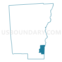
Outline

Summary
| Unique Area Identifier | 626011 |
| Name | Voting District 020001 |
| County | Chenango County |
| State | New York |
| Area (square miles) | 18.15 |
| Land Area (square miles) | 17.73 |
| Water Area (square miles) | 0.42 |
| % of Land Area | 97.68 |
| % of Water Area | 2.32 |
| Latitude of the Internal Point | 42.27947330 |
| Longtitude of the Internal Point | -75.44353390 |
Maps


Graphs
Select a template below for downloading or customizing gragh for Voting District 020001, Chenango County, New York


Neighbors
Neighoring Voting District (by Name) Neighboring Voting District on the Map
- Voting District 010002, Chenango County, NY
- Voting District 020002, Chenango County, NY
- Voting District 070001, Chenango County, NY
- Voting District 070002, Chenango County, NY
- Voting District 120001, Delaware County, NY
- Voting District 160002, Delaware County, NY
- Voting District 160004, Delaware County, NY
- Voting District 160005, Delaware County, NY
- Voting District 230003, Otsego County, NY
Top 10 Neighboring County Subdivision (by Population) Neighboring County Subdivision on the Map
- Sidney town, Delaware County, NY (5,774)
- Unadilla town, Otsego County, NY (4,392)
- Bainbridge town, Chenango County, NY (3,308)
- Guilford town, Chenango County, NY (2,922)
- Afton town, Chenango County, NY (2,851)
- Masonville town, Delaware County, NY (1,320)
Top 10 Neighboring Place (by Population) Neighboring Place on the Map
Top 10 Neighboring Unified School District (by Population) Neighboring Unified School District on the Map
- Sidney Central School District, NY (7,667)
- Bainbridge-Guilford Central School District, NY (5,406)
- Afton Central School District, NY (3,974)
Top 10 Neighboring State Legislative District Lower Chamber (by Population) Neighboring State Legislative District Lower Chamber on the Map
Top 10 Neighboring State Legislative District Upper Chamber (by Population) Neighboring State Legislative District Upper Chamber on the Map
- State Senate District 42, NY (313,027)
- State Senate District 51, NY (296,420)
- State Senate District 52, NY (290,862)
Top 10 Neighboring 111th Congressional District (by Population) Neighboring 111th Congressional District on the Map
Top 10 Neighboring Census Tract (by Population) Neighboring Census Tract on the Map
- Census Tract 9704, Delaware County, NY (5,774)
- Census Tract 9709, Chenango County, NY (5,058)
- Census Tract 5916, Otsego County, NY (4,392)
- Census Tract 9705, Delaware County, NY (4,279)
- Census Tract 9708.01, Chenango County, NY (3,921)